Plan your next adventure with our round-up of the very best road trips in the UK – as voted for by Boundless members
Here's a round-up of our 50 best British drives, selected by experts and voted for by Boundless members. Did your favourite drive make the list?
If there’s one thing we know about Boundless members, it’s that you love to head out for some quality drive time. Well, if you want some inspiration for your next road trip, you've come to the right place.
We asked our expert motoring panel to recommend 50 of the best UK drives, then asked Boundless members to vote for their favourites. Our partner LV= kindly helped the project along.
The result is a countdown of the best UK road trips, covering everywhere from the Scottish Highlands down to the Cornish coastline, with many, many detours in between. We’ll let you know what to expect, while links to the routes on Google Maps will help you to navigate your way around. So, get comfy and start planning your next adventure. Oh, and once you've completed the journey, let us know what you made of it by emailing hello@boundlessmag.co.uk.
All of the routes listed come under one of the following categories: Countryside, Urban, Twists and Turns, Food and Drink, Forest and Woodland, Hills and Dales, or Coastal Drives, so you can pick the road trip that suits your mood.
Planning to drive during the winter months? Read our essential winter driving tips.
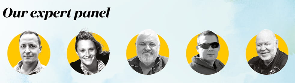
Left to right:
Dan Read, Motoring Editor
With 15 years of car journalism under his belt, there’s barely a British road Dan hasn’t driven – so who better to help us put together our hit list?
Vicki Butler-Henderson, Columnist
Having raced since she was just 12 years old, Vicki knows exactly what makes a great driving road.
Ron Still, Boundless Motorcycle Group Secretary
For the past 50 years, Ron has been travelling the length and breadth of the country to attend rallies, and he added some surprising routes to the mix.
Richard Ashcroft, Boundless Motorcycle Group Leader
A die-hard devotee of twists and turns, Richard has chosen routes that will keep both drivers and riders on their toes…
Allan Goddard, Club Captain
Club Captain for 15 years, Allan loves pretty much all things on wheels – motorbikes, cars, classic vehicles – and is dedicated to getting the best from them.
50. Bedford to Kimbolton, East of England
Countryside. 16 miles. Follow this route on Google Maps
Our tour of the best UK drives begins just outside the county town in rural Bedfordshire, on the B660 as it unfurls across open farmland, criss-crossed by the brooks and tributaries of the River Great Ouse, and passes near the Bedford Autodrome to the west – worth a visit if there’s a track day on – before carrying you into Cambridgeshire.
49. Litlington to A1, Hertfordshire, East of England
Twists and Turns. 14 miles. Follow this route on Google Maps
Packed with a riveting selection of corners, you could lift sections and place them onto some of the best bends at Silverstone, Spa and Monza. There are blind crests, adverse cambers, tight turns, never-ending ones, undulations, chicanes and double apexes. You’ll start on a two-mile straight just off the A505 near Royston that leads into Litlington, then it’s onwards to the B1042 out of Wrestlingworth, head to Potton and then Sandy to join the A1.
48. Stafford to Newport, West Midlands
Countryside. 27 miles. Follow this route on Google Maps
A loop around the lanes west of Stafford. Follow these waypoints and you’ll have a blast: A5013 to Great Bridgeford, B5405 to Woodseaves, A519 to the A41, then back towards Stafford on the A518, through Gnosall and into Haughton village. Best enjoyed on a quiet morning on two wheels – and it encircles the Aqualate Mere Nature Reserve, with its large lake, if you want to stretch your legs too.
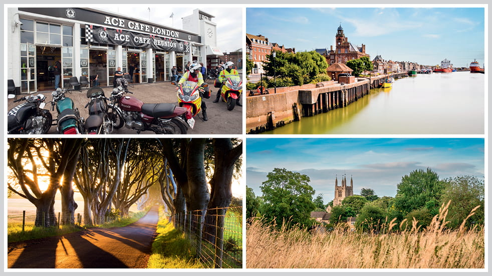
Road trips 47, 45, 44 and 43: Maidenhead to London, the Dark Hedges, Great Yarmouth and East Midlands
47. Maidenhead to London (Jenner’s Café to Ace Café), South East
Food and Drink. 24 miles. Follow this route on Google Maps
The busy Ace Café, just off London’s equally jam-packed North Circular Road, is a magnet for petrolheads of all persuasions, though it’s best known for its biker gatherings. Built in 1938, it was wrecked in a Second World War air raid on a nearby railyard, but later rebuilt. In the ’50s and ’60s it became a hangout for leather-jacketed rockers, and then for rocker-revivalists in the ’90s. It’s the perfect endpoint for a ride, or indeed drive, from another café, Jenner’s, in Maidenhead. From there, cross the Thames on the A4 and turn left to Taplow, heading north on the leafy Cliveden Road and past the magnificent Cliveden House, before taking the M40/A40 to the outskirts of London for a hearty second breakfast.
46. The B660, Bedfordshire, East of England
Twists and Turns. 23 miles. Follow this route on Google Maps
A keen driver won’t want for anything here. There are slow corners to perfect your steering precision, fast ones to test your road-reading skills, rolling sections for suspension assessments and then there are the must-have twists and turns that come in the shape of hairpins and chicanes. It’s such a gem of a route that it won’t matter if you’re in a 4x4 or a two-seater sportscar – whatever you drive, you’ll get to the end with a long-lasting smile and a quick heartbeat.
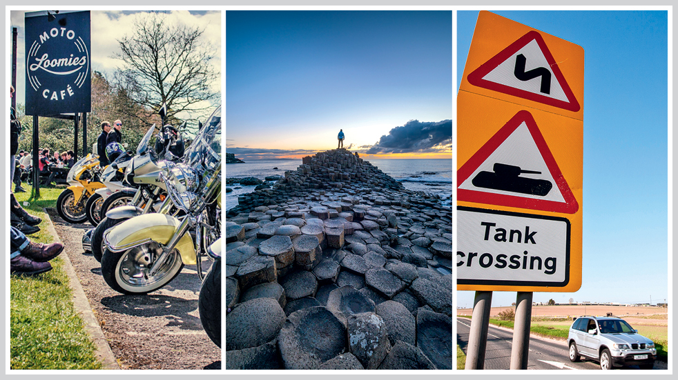
45. Bregagh Road, Country Antrim, Northern Ireland
Forest and Woodland. 0.5 miles. Follow this route on Google Maps
This 18th-century avenue, once the original driveway of nearby Gracehill House, is formed of 150 arched beech trees that create a dramatic tunnel over the road. Nicknamed the Dark Hedges, it’s perhaps better known to many Game of Thrones fans as the fictional ‘Kingsroad’, after it was used as a location for the TV show. Sadly, its fame led to hordes of visitors and then to concerns that the resulting traffic was damaging the trees, and in late 2017 it was closed to cars. So it’s now more of a great stroll than a great drive, but it’s in the list because this is still a spectacular road, even at walking pace.
44. Romford to Great Yarmouth, East of England
Forest and Woodland, and Food and Drink. 128 miles. Follow this route on Google Maps
This route takes you from within the M25 out through greenest Essex and into East Anglia, where the landscape flattens and big skies dominate, before ending with a scenic dash across the Norfolk Broads and into Great Yarmouth for some well-earned fish and chips. That is, if you haven’t already had a plateful at one of the countless village pubs along this varied route, which features everything from ruler-straight Roman roads to urban twists and turns. If you have time, the headquarters of Lotus Cars is only a short diversion from the A11 near Norwich. You can book a tour of the working factory and also of the heritage collection – it’s well worth the effort.
Members get an exclusive saving on LV= car insurance
Get covered with Defaqto 5 Star rated car insurance and you’ll be on the road in no time!
43. Colsterworth to Bourne, East Midlands
Twists and Turns. 14 miles. Follow this route on Google Maps
This stretch packs in a lot, from long, sweeping bends to 90-degree turns and swishing left-right combos (especially around Hawthorpe and Bulby). In fact, it’s so varied that it’s used by some bike instructors as a training route for the IAM Advanced Riding Test. It’s also very accessible, being strung between the A1 to the west and A15 to the east, from Colsterworth to Bourne, or vice versa. The road is narrow in places, but visibility is good – the hedgerows are either very low or non-existent, though beware the drainage ditches on either side of the road. If you’re not careful, they’ll swallow you whole.
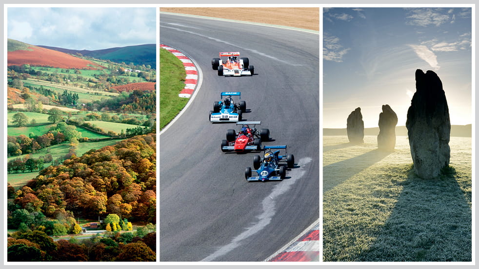
Road trips 42, 41 and 40: Powys in Wales, Brands Hatch racing track, and North Wessex Downs
42. A483, Newton to Crossgates, Wales
Food and Drink, and Twists and Turns. 24 miles. Follow this route on Google Maps
The A483 runs between Swansea and Chester, but the best section is in the heart of the Powys countryside from Newtown to Crossgates. This is a real wriggler, with almost as many bends as the adjacent River Ithon. Tackle it from north to south, starting at Newtown with a coffee stop at the New Inn at Llanbadarn Fynydd, an old coaching house with a waterfall in the garden. At Crossgates’ service station, you can refuel your tank and your tummy – before turning around and doing it all again, or heading west to Rhayader, gateway to the Elan Valley.
41. Brands Hatch, Kent, South East
Twists and Turns. 2.4 miles. Follow this route on Google Maps
No round-up of the best UK drives is complete without mentioning Brands Hatch. The legendary racing circuit played host to Vicki Butler-Henderson’s first race in a car – a Formula First single-seater – so it’s close to her heart. Having started off as a motocross circuit in the 1920s, it was later surfaced with tarmac, and later still became home to the British F1 Grand Prix from the 1960s to the 1980s. It's almost four miles long, but there is a more popular, shorter Indy track which is just over a mile long and that’s the one Vicki raced. Both allow you to experience the exhilaration of the compression at the bottom of the steep first corner, Paddock Hill Bend – it’s unrivalled on a British circuit.
40. A4, Chippenham to Newbury, South West
Food and Drink. 40 miles. Follow this route on Google Maps
As an alternative to the chock-a-block monotony of the M4, exit at either Chippenham (J17) or Newbury (J13) where you can pick up the parallel A4, the original Bristol-London road. It’s wide, well-surfaced and often much quieter than its motorway counterpart. For this section the road sweeps through the North Wessex Downs, a high sea of sloping fields bisected by the ancient Ridgeway, a chalky escarpment and the A4 of its day. The Polly Tea Rooms in Marlborough is a cake-lover’s paradise, while history buffs will love the Neolithic stone circle at Avebury and the mysterious Silbury Hill, yards from the main road.
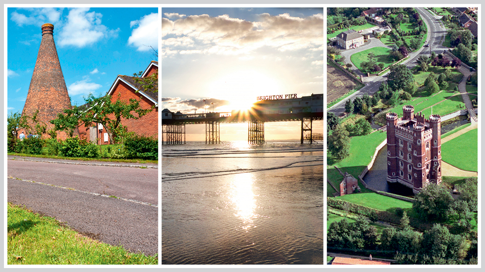
Road trips 39, 38 and 37: Reading to Oxford in the Chilterns, Crawley to Brighton and Sleaford to Cadwell Park
39. Reading to Oxford, South East
Forest and Woodland, and Food and Drink. 31 miles. Follow this route on Google Maps
After trickling out of Reading’s prosperous northern suburbs, the B481 runs through shaded woodland and clips across the southern reaches of the Chilterns. After Nettlebed, with its brick kiln (see above), the route doglegs north-westwards on reaching Watlington and becomes the B480, a relaxed stretch of road threaded through a handful of equally laid-back villages and hamlets. There are no switchbacks or hairpins, but sometimes a great drive isn’t about that. You can imagine this one on a crisp autumn morning, roof down, on the way to Sunday lunch among Oxford’s spires. Or if you’re doing it in the other direction, by the riverside in Henley-on-Thames.
38. Crawley to Brighton, South East
Coastal. 22 miles. Follow this route on Google Maps
Nothing sums up a Great Escape quite like a seaside getaway. This particular one starts in Crawley where, if you’re lucky, the gridlock finally gives way to the free-flowing, dual-carriageway A23, which whizzes you to Brighton in no time. But perhaps you’d prefer a more sedate pace, like entrants in the annual London to Brighton veteran car run. A well-loved event, this is a recreation of the Emancipation Run of 1896 held to celebrated the ‘Locomotives on the Highways Act’, which raised the speed limit from 4mph to 14mph and removed the need for someone to walk in front of the car.
37. Sleaford to Cadwell Park, Lincolnshire, East Midlands
Countryside. 31 miles. Follow this route on Google Maps
This rural route was well-driven by Vicki Butler-Henderson when her Formula First race team was based at Cadwell Park racing circuit – but nostalgia is not why it’s here. From Sleaford, you head briefly north on the B1517, then east and pick up the A153. The A153 is a wonderful roller coaster of a road (pictured above, near Tattershall). There are plenty of camber changes, so make sure both hands are glued to the wheel at all times (unless you’re changing gear). And once you’re at Cadwell Park, why not do a track day?
Road trips 36, 35 and 34: the Mourne Mountains in County Down, the Brecon Beacons, and Central London
36. Newcastle to Slieve Gullion, Northern Ireland
Coastal. 40 miles. Follow this route on Google Maps
Our next drive curls around the Mourne Mountains in the south-east corner of County Down and into Armagh. Starting in Newcastle, once a haven for smugglers, you head down the coast road with Slieve Donard – Northern Ireland’s highest mountain – on your right and the Irish Sea on your left. Soon you cut inland, through the bleakly beautiful Mournes, which at times seem to glow purple. Your final stop is the Ring of Gullion, an Area of Outstanding Natural Beauty that includes a forest park and Giant’s Lair – a magical kids' story trail inspired by local legends.
35. Garnlydan to Llangynidr, Brecon Beacons, Wales
Twists and Turns. 6 miles. Follow this route on Google Maps
Our tour of the best UK drives continues into Wales now, for a short but spectacular section of the B4560 in the Brecon Beacons. From the village of Garnlydan, the road quickly rises onto open moorland (pictured above) and wiggles into the distance with nothing but the odd sheep between you and the horizon. Then comes the action-packed middle bit, a roller-coaster ride of swooping downhill straights, fast curves and a pair of elbow-shaped hairpins, before the tarmac rears uphill again as you near Llangynidr. At the weekend the whole area is alive with the sounds of auto-exotica, from Ferraris to fast Fords and screaming superbikes. Take care up there.
34. A lap of Central London, South East
Urban. 10 miles. Follow this route on Google Maps
By day, it’s clogged with traffic and tourists. By night, it’s essentially an empty street circuit (so long as you stay within the rules of the road, of course). Starting with your back to Buckingham Palace, head down the Mall and through Admiralty Arch. Swing left and loop around St James’s before popping into Piccadilly Circus, illuminated by the eerie glow of big screens. Head south to Trafalgar Square and down Whitehall until Big Ben fills your windscreen. Next, hook left onto Embankment and follow the Thames east to Tower Bridge. Cross the river and turn right, beneath the towering Shard and along the South Bank with all its sparkling lights, to Westminster Bridge. From there it’s over to Parliament Square, up Birdcage Walk and back to the Palace to complete your lap of London.
Road trips 33, 32 and 31: South Down Loomies Moto Café, Causeway Coastal Road in Northern Ireland, and Salisbury Plain
33. Loomies Moto Café to Winchester, South East
Food and Drink. 12 miles. Follow this route on Google Maps
Slap-bang in the middle of the South Downs, Loomies Moto Café is a hangout for anyone who is a) into motoring on either two wheels or four, or b) hungry. Its menu is apparently designed for people who’ve not eaten for weeks – for example, the £11 Race Pro breakfast is a lavish festival of pork – and if you order muesli you may get some funny looks. Located on an intersection just north of West Meon, the A32 and A272 pass right outside the front door. Follow the latter west and you’ll enjoy a well-surfaced, flowing ride, or drive through the woods and over the hills to Winchester. That’s if you can move after eating.
32. Causeway coastal road, Northern Ireland
Coastal. 80 miles. Follow this route on Google Maps
The northern leg of the A2 runs roughly alongside the wild North Atlantic coast on miles of seemingly little-used tarmac. Along the way you’ll pass some of Northern Ireland’s national treasures, including the world-famous Giant’s Causeway – it’s absolutely worth breaking your journey for a closer look. You’ll also find the Carrick-a-Rede Rope Bridge (not for the faint-hearted), the dramatic ruins of Dunluce Castle perched high on a clifftop (also not for the faint-hearted) and Portrush, the venue for the annual North West 200 motorcycle road race (you’ve guessed it!).
Members save on every car with LV= Multi Car
Taking more than one car? Insure up to six cars on the same policy and get a discount for each one. Please note all cars on the policy must be registered at the same address.
31. Bulford Camp to Everleigh, South West
Countryside. 6 miles. Follow this route on Google Maps
‘WARNING TO PUBLIC. DANGER FROM UNEXPLODED BOMBS. ON NO ACCOUNT SHOULD ANY OBJECT BE TOUCHED. IT MAY EXPLODE.’ So reads the sign at the entrance to the Old Marlborough Road, one of countless public byways zigzagging over Salisbury Plain, the UK’s largest military training area. Despite the warnings, the chances of encountering unexploded ordnance are slim, although do check the firing times and respect red flags. And watch out for speeding tanks (then give way). There are other rules to bear in mind – search online for the Salisbury Plain training area Greenlaning Good Practice Guide – but so long as you follow them, you’ll enjoy some of the country’s best off-roading.
Roads trips 30, 29 and 28: Wilton to Honiton in Devon, Wales' Wye Valley and the South Downs
30. A30, Wilton to Honiton, South West
Food and Drink. 70 miles. Follow this route on Google Maps
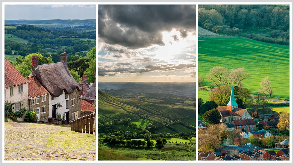
For those of us without a helicopter, there’s no easy way to get from London to Land’s End. So why not embrace the slowness with a gentle drive down the A30, Britain’s third-longest A-road, which slices diagonally from the capital to Cornwall? The stretch between Wilton in Wiltshire and Honiton in Devon is especially pretty, as it transports you back in time through storybook towns with cobbled streets and old-fashioned sweet shops. The many highlights along the way include Gold Hill in Shaftesbury (you may recognise it as the road from the famous Hovis ad), Sherborne farmers’ market and the Happy Humbug in Honiton.
29. Chepstow to Usk via B4235, Wales
Forest and Woodland, and Hills and Dales. 14 miles. Follow this route on Google Maps
A classic British B-road through shaded woodland and patchwork countryside, popular with bikers and drivers alike. But keep your wits about you, as there are all sorts of side roads and blind bends that can easily catch you out – particularly around the twistier southern end. Further north it climbs into the hills and opens up, and from Usk you can join the A449 and A40 to Monmouth. From there, the beautiful Wye Valley (pictured above) is yours to explore, whether you choose to go north via Symonds Yat or south via Tintern to see the grand, roofless ruins of the old monastic abbey.
28. South Harting to Lordington via B2146, South East
Hills and Dales, and Food and Drink. 7 miles. Follow this route on Google Maps
Another South Downs favourite, the B2146 is one of three or four routes leading to Goodwood House and Circuit, home of the annual Festival of Speed and Revival Meeting, plus countless other motorsport events. Together they form a sort of pilgrim’s trail for petrolheads, who must visit Goodwood at least once. If you’re heading that way, take your pick from the B2141, A286, A285 or A272. Or spend a happy day linking them all together, threading your way through some of England’s greenest and most pleasant lands, with pit-stops in picture-perfect village pubs.
Road trips 27, 26 and 25: High Weald in Kent, Brecon Beacons in Wales, and Larne to Cushendall in Northern Ireland
27. Sevenoaks to Folkestone, South East
Coastal, and Hills and Dales. 78 miles. Follow this route on Google Maps
From the M25 and Sevenoaks, the A21 whisks you through Kent and East Sussex through High Weald, the fourth-largest Area of Outstanding Natural Beauty in England and Wales, and a mosaic of farm fields, sunken valleys and forested ridges. At the southern end it’s worth a small diversion to the town of Battle, with its links to the Battle of Hastings. Back on the route at Hastings, turn left onto the sweeping A259 and follow it along the coast, past Dungeness and the Romney Marshes, all the way around to Folkestone. Along the way you’ll see signs of the area’s tumultuous past, including Martello towers – cylindrical defensive forts – and several castles.
26. Abergavenny to Aberystwyth, Wales
Twists and Turns, and Hills and Dales. 82 miles. Follow this route on Google Maps
Time now for a long and winding road trip through the heart of Wales, starting on the southern edge of the Brecon Beacons and ending several hours later in Aberystwyth, halfway up the coast via the A40, A479, A470 and A44. The waypoints are almost sacred among motoring types: Crickhowell, Builth Wells, Rhayader – and all lie at the intersections of yet more dreamy drives. The route is composed of relentlessly rewarding A-roads, with long expanses of national speed limits. Saving the best ’til last, the final stretch of the A44 features corners seemingly lifted from racetracks and draped over the landscape for your amusement.
25. Larne to Cushendall, Northern Ireland
Coastal. 24 miles. Follow this route on Google Maps
The Northern Ireland coast is so popular, we’re back for another visit, this time for an invigorating, 24-mile jaunt from Larne to Cushendall; carry on going and you’ll link up to the northerly section described in #32 on the list. Starting just 30 minutes north of Belfast, this low-lying part of the A2 runs so closely to the sea that the water virtually laps over the tarmac, and on a windy day your wipers will be swishing away salty spray. At Cushendall there’s a sweep of sandy beach, and behind it the table-topped Lurigethan Mountain at the meeting point of Antrim’s three glens. Stunning.
Road trips 24, 23 and 22: Edinburgh to Darlington, Cranbourne Chase and North Pennines in Cumbria
24. Edinburgh to Darlington via A68, Scotland, North East
Hills and Dales. 136 miles. Follow this route on Google Maps
Reaching from the outskirts of Edinburgh all the way to Darlington, the A68 traces large sections of a Roman road known as Dere Street, which once connected York to Scotland through Hadrian’s Wall. The most dramatic part is where it crosses the Anglo-Scottish border at Carter Bar, a high point in the Cheviot Hills with views for miles in all directions. Here the road is a Big Dipper, with tall crests, runaway descents and looping curves. And on the English side is Northumberland National Park, a Dark Sky Reserve and one of the best places in the world for stargazing.
23. Warminster to Poole, South West
Countryside, 40 miles. Follow this route on Google Maps
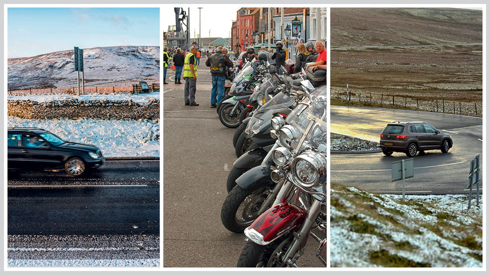
From Warminster to Poole over the chalky grassland of Cranborne Chase, the A350 lies like an untied shoelace over the countryside. On a clear day it conveys you speedily to the south coast, skirting rustic Dorset market towns such as Shaftesbury and Blandford Forum. For those on two wheels, it’s a great route to the weekly ‘bike night’, held every Tuesday from April to September on Poole Quay, where the road is closed to four-wheeled traffic, and motorcycles are lined up in long rows like dominoes. It’s not unknown for more than 1,000 riders to turn up from far and wide.
22. Haydon Bridge to Penrith via A686
Hills and Dales. 37 miles. Follow this route on Google Maps
It doesn’t matter which end you start from – by the time you’ve driven all 37 miles of the A686, you’ll want to turn around and do it again. The road meanders over the North Pennines to a high point on the Hartside Pass in Cumbria, once home to what was reputed to be the highest café in England until it was sadly destroyed by fire last spring. The southern half rushes across open moors with long and distracting views towards the Lake District, and across the Solway Firth to Scotland beyond. What to expect? Giant hairpins and smiley faces.
Road trips 21, 20 and 19: Bristol's Clifton Suspension Bridge, the Trossachs and Cairngorms, and the TT motorcycle course on the Isle of Man
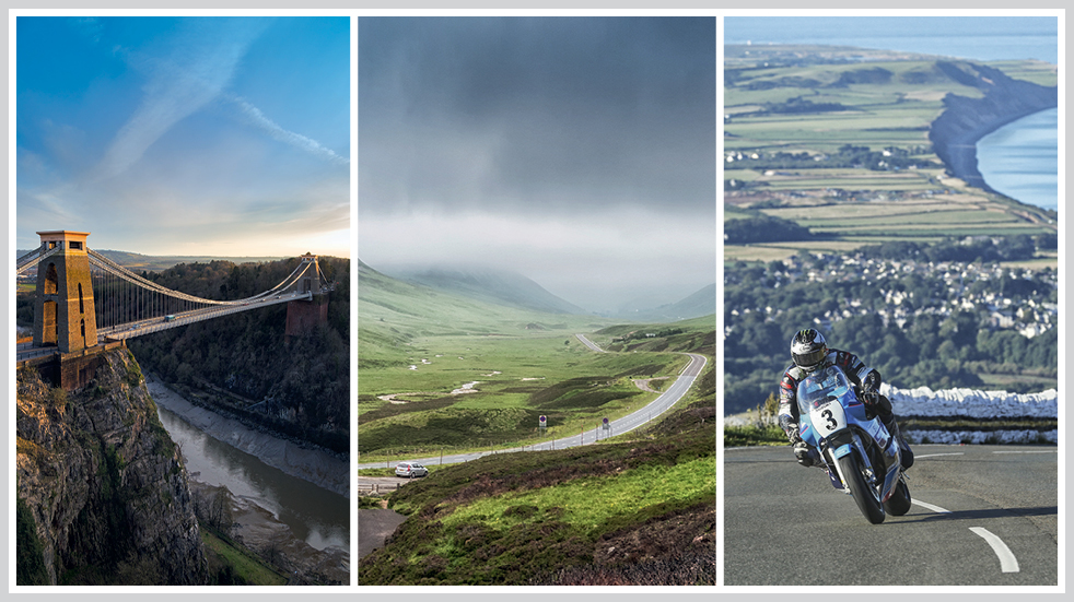
21. Clifton Suspension Bridge, Bristol, South West
Urban. 400 metres. Follow this route on Google Maps
Even the visionary Isambard Kingdom Brunel may not have imagined that the suspension bridge he initially designed in 1831 (and was finally completed in 1864) would, in the distant future, carry more than 8,000 vehicles per day, plus countless bicycles and pedestrians. Connecting Bristol to North Somerset across the Avon Gorge, the bridge spans 214 metres between its towers and hangs 76 metres above the high-water line. A single crossing by car costs £1, and despite the traffic figures you’ll often have it all to yourself. For the full, dizzying experience, park up and walk across.
Boundless members get an exclusive saving on LV= home insurance
Make sure your home is insured while you’re away with Defaqto 5-star rated LV= Home and Home plus Insurance.
20. Glasgow to Inverness, Scotland
Forest and Woodland. 224 miles. Follow this route on Google Maps
A blast up the backbone of Scotland is one of the greatest ways to blow the cobwebs away. With Glasgow behind you, work your way up the side of Loch Lomond on the glorious A82 into the wooded glens of the Trossachs. Resist the temptation to follow the road up to Fort William (we’ll come to that later), and instead cut across to the Cairngorms. The A9 will have you in Inverness in a flash, but if you have time, head over to Pitlochry and up the river-like Cairnwell Pass, the highest main road in the UK. At the summit it cuts through Glenshee Ski Centre then streams down to Braemar – of Highland Games fame – and past Balmoral Castle.
Members save 5% on LV= travel insurance
Planning a holiday as part of your road trip? If your things get lost or stolen, LV= can cover your luggage and valuables.
19. TT motorcycle Course, A18, A3, A1 loop, The Isle of Man
Twists and Turns. 37.7 miles. Follow this route on Google Maps
For a fortnight in May and June, the world’s bravest road racers gather on the Isle of Man for the TT motorcycle races, run on the island’s public roads where riders thread between telegraph poles, phone boxes and doorsteps at superhuman speeds. Starting and ending in Douglas – where the grandstands and giant leaderboard are permanent fixtures – the lap loops around the northern half of the island and rushes back to Douglas on the A18, the Mountain Road, which is both scenic and swift (even outside of race week, there’s no legal speed limit).
Road trips 18, 17 and 16: the Black Mountain Road in the Brecon Beacons, the Jurassic Coast: Weymouth to West Bay, and the Norfolk coast
18. The Black Mountain Road, Brecon Beacons, Wales
Hills and Dales, and Twists and Turns. 12 miles. Follow this route on Google Maps
The Black Mountain Range is the most westerly of the Brecon Beacon uplands, and home to one of the great Welsh drives, the A4069 Black Mountain Road connecting Upper Brynamman and Llangadog. At its most entertaining, the tarmac soars over the bare hilltops, where the road builders added curves for seemingly no other reason than putting a smile on your face. Viewed from the air, it looks like an unravelled party streamer and, sure enough, the whole thing feels like a proper celebration of driving. There are also plenty of laybys where you can stop for a selfie and a sandwich (sometimes there’s even an ice-cream van around, if you’re lucky).
17. Cromer to Hunstanton, East of England
Coastal. 38 miles. Follow this route on Google Maps
It’s just under 40 miles from the pier at Cromer to the bright lights of Hunstanton’s amusements via the A149. On a good run it takes around an hour so, but that could easily turn into an entire day or more with stop-offs. At Blakeney, you could take a boat trip to see the largest seal colony in England, or stroll along the Norfolk Coast Path through the salt-marsh nature reserves. At Wells-next-the-Sea, you could spend ages strolling down the long line of pastel-coloured beach huts – just beware the crowds in peak season, or rise and shine very early. And at Burnham Overy Staithe, you could take a walk and watch the boats in the harbour. Perhaps you could turn this drive into two days…
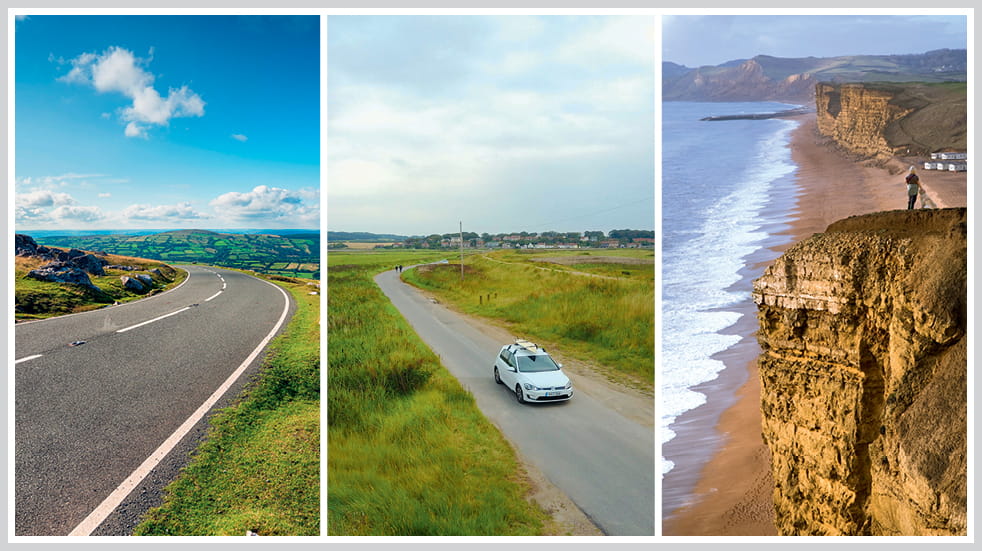
16. Weymouth to West Bay via B3157, South West
Coastal. 18 miles. Follow this route on Google Maps
The B3157 follows the line of the pencil-thin Chesil Beach from Weymouth to West Bay. At the highpoint above Abbotsbury, you can see for miles, from the red-and-white-striped Portland Bill lighthouse at one end to honey-coloured cliffs at the other. In between, there are all sorts of undulations as the road leaps along the cliffs, giving you butterflies over blind crests and into plunging dips. If you’d rather take in the prehistoric vistas than concentrate on driving, you could always hop onto the top deck of the X53 ‘Jurassic Coaster’ bus, which runs regularly along the route.
Road trips 15, 14 and 13: Cornwall, the Fosse Way, and Bealach na Bà in Scotland
15. Boscastle to Bude, Cornwall, South West
Coastal. 25 miles. Follow this route on Google Maps
Wiggling between the mythical Tintagel Castle – said to be the place of King Arthur’s conception – to the beach at Bude, this drive is as Cornish as Poldark’s pasty. Out of Tintagel, the B3263 hugs the wild coast to Boscastle, a tiny harbour village set deep in a rocky inlet. Once a haunt of Thomas Hardy, whose wife hailed from a nearby hamlet, it’s now home to a Museum of Witchcraft and Magic. From there you can carry on along the B-road until the A39, or squeeze between the brambles on clifftop lanes, dropping into smugglers’ coves and intersecting at times with the South West Coast Path.
14. Cirencester to Moreton-in-Marsh via A429, Midlands
Countryside. 24 miles. Follow this route on Google Maps
Once upon a time, the Fosse Way was a Roman road connecting Lincoln and Exeter via an almost dead-straight marching route. Today, its path remains largely intact, traced by modern roads such as the A429. Cutting diagonally across the Cotswolds, it takes you from one pretty town to another, requiring only the merest turn of the steering wheel between long and leafy straights. The wonderful Motoring Museum and Toy Collection in Bourton-on-the-Water, where Boundless members enjoy a 10% discount, makes a rewarding pit-stop.
13. Tornapress to Applecross via Bealach na Bà, Scotland
Hills and Dales, Twists and Turns, and Food and Drink. 11 miles. Follow this route on Google Maps
The Bealach na Bà is like any of the great Alpine passes, except for the fact it’s in Scotland. Deep in the northwest Highlands, it’s a sinuous, single-track climb over the weathered peaks of the Applecross peninsula, and has one of the steepest ascents of any paved road in Scotland. Once a drovers’ route – its name translates as ‘pass of the cattle’ – it was made a road sometime around 1822, though it remains at the mercy of the weather (in winter the gates are often pulled across the entrance). From the top you can see the Isle of Skye to the west, while behind you – way back down at the foot of the pass – is Loch Kishorn. On the far side, fresh seafood and other local produce awaits you at the Applecross Inn.
Exclusive savings on breakdown cover with Britannia Rescue
Put yourself and your car in safe hands with access to over 4,000 breakdown professionals.
Road trips 12, 11 and 10: Horseshoe Pass in Wales, the Northumberland coast, and Exmoor
12. Llangollen to Llandegla via A542, Horseshoe Pass, Wales
Hills and Dales, and Food and Drink. 9 miles. Follow this route on Google Maps
Just over the Welsh border from Shrewsbury, the A5 runs through Llangollen, from where the A542 shoots off north over the hills. Otherwise known as the Horseshoe Pass – one look at a map explains its name – it splits two mountains, Llantysilio to the west and Maesyrchen to the east. It’s wide and smooth and steep. Before you know it, you’re zooming beneath the clouds, swerving for the odd sheep, and probably stopping every few hundred yards to gaze out over the hills. But be warned, the weather rules the roost up here, and not just in the icy months – in summer 2018, the pass was closed due to wildfires. Thankfully, the ever-popular Ponderosa Café survived. For 33 years – and every day except Christmas Day – it has fed, watered and refreshed drivers, bikers, cyclists, hikers and anyone else who makes the trek to the 417-metre summit.
11. Alnmouth to Holy Island via A1068, B1339, B1340, North East
Coastal. 37 miles. Follow this route on Google Maps
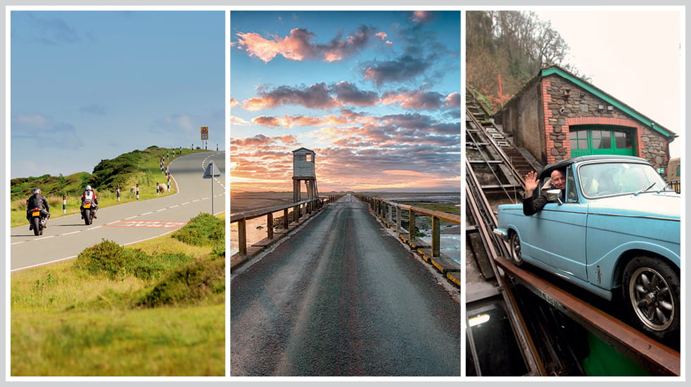
The Northumberland Coast Area of Outstanding National Beauty covers the last 40 miles of England’s far north-eastern tip before the Scottish border. For most of its length, the only thing between you and the North Sea is a wide strip of grassy dunes and sandy beaches, once the landing point for raiding Viking longships. The area’s embattled past is evident everywhere – Northumberland has more castles than any other county, several of which are strung along this sparsely populated stretch of shoreline, along with numerous pele towers (fortified keeps where signal fires were lit to warn of approaching danger).
Starting at Alnmouth, work your way northwards on the A1068, B1339 and B1340, passing Boulmer, Dunstanburgh Castle, Beadnell, Seahouses and Bamburgh, before skimming over the causeway at low tide to the Holy Island of Lindisfarne, home of a medieval monastery and 16th-century castle. Be sure to check the tides to plan your drive back – the causeway can disappear unnervingly quickly.
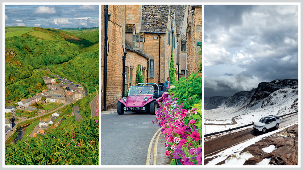
10. Exford to Lynmouth, South West
Forest and Woodland, and Hills and Dales. 14 miles. Follow this route on Google Maps
Starting in the old-world heart of Exmoor at Exford in Somerset, head west to Simonsbath and take the B3223 as it races up onto the moor above the treeline. For a while it streaks over the rust-and-copper-coloured heaths where, on a good day, the only traffic consists of woolly livestock and wild ponies, which roam free and have a habit of blending into the scenery. After five miles or so the road crosses the county border into Devon and plunges through a rocky, wooded gorge into Lynton and Lynmouth – twin towns separated by high cliffs but joined by a water-powered funicular railway.
Road trips 9, 8 and 7: Aberystwyth mountain road, the Trotternish circuit on the Isle of Skye, and Snake Pass in the Peak District
9. Rhayader to Aberystwyth, Wales
Hills and Dales, and Twists and Turns. 30 miles. Follow this route on Google Maps
The Aberystwyth mountain road runs alongside one rushing river after another, flowing just as swiftly through the long valley all the way to Cardigan Bay. On a map it’s a 30-mile length of loose string, tied at one end to the mid-Wales market town of Rhayader and to Aberystwyth’s promenade at the other. In between is one of the wildest rides on this list, where in places the tarmac seems narrower than a bowling alley. But no matter: with very few trees or hedgerows – for the most part it’s a panorama of grassy slopes and plateaus – you’ll see oncoming traffic about 20 minutes before it arrives.
This drive takes you via the B4574 and A4120 – but about four or five miles outside of Rhayader there’s a turnoff to the Elan Valley, where you can drive around the Victorian reservoirs (built to supply drinking water to Birmingham, 70 miles away) and along the tops of dams.
8. Trotternish Circuit, Isle of Skye
Coastal, and Hills and Dales. 41 miles. Follow this route on Google Maps
Starting and finishing in the island capital of Portree, the A855 lassoes around the stunning Trotternish peninsula on the Isle of Skye – but instead of driving all the way up to the northern tip of the island, we recommend taking the route across the peninsula between Staffin and Uig, going into the heart of the Quiraing. It’s 41 slow-going miles in total, but this one’s not about speed, it’s about scenery. The entire east coast of the peninsula is a post-glacial landslip with all sorts of otherworldly formations poking out of it, most famously the jagged volcanic spire of the Old Man of Storr, and the foreboding, castle-like rocks of the Quiraing. If the landscape feels familiar, it’s because you’ve probably seen it all before, in films such as The BFG and King Arthur: Legend of the Sword.
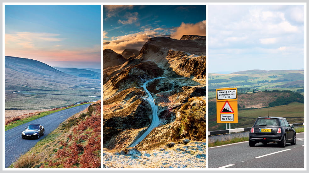
7. Glossop to Sheffield via the A57 Snake Pass, West Midlands
Twists and Turns, and Food and Drink. 24 miles. Follow this route on Google Maps
The Snake Pass – which crosses the Peak District between Manchester and Sheffield – is arguably England’s most infamous road, known as much for its serpentine curves as its dubious safety record and frequent winter closures. Its name, incidentally, derives not from its relentless writhing, but from the Snake Inn near the summit, which took its name from its original owner’s coat of arms (it pictured a snake). Although today the pub is actually called the Snake Pass Inn. In other words, the Snake Pass Inn was originally called the Snake Inn, but is now named after the pass itself, which in turn was named after the pub. Glad we could clear that up…
Road trips 6, 5 and 4: Exmoor Valley of Rocks and Porlock, Scotland's North Coast 500 and North York Moors
6. Lynmouth to Minehead, South West
Coastal. 19 miles. Follow this route on Google Maps
This one starts where #10 finished, in Lynmouth on the Exmoor coast. But before we head east on the A39, it’s worth quickly nipping out of town to the west and through the clifftop Valley of Rocks, with its giant stone stacks and house-sized boulders. With that done, head out of Lynmouth up Countisbury Hill, noting the steep drop and distinct lack of a guardrail between you and the sea far below.
The drive becomes less nerve-racking as you head east, following the A39 along the top of the National Park, where it butts up to the Bristol Channel. The road arcs gracefully for a few miles before diving down Porlock Hill, possibly England’s steepest A-road with a maximum gradient of 1 in 4 (in Porlock village you’ll often get a whiff of burning brakes as cars finally reach the bottom and their drivers begin to breathe again).
5. North Coast 500, Scotland
Coastal, and Twists and Turns. Around 500 miles. Follow this route on Google Maps
The driving holiday of your dreams could be found on the aptly named 500-mile route around parts of northern Scotland. Sweeping roads will take you from a potential starting point in Inverness and then propel you westward to Applecross, then north to Durness, east to John O’Groats and back south to Inverness.
There will be plenty of breathtaking vistas with ‘oh, wow’ moments – and however many days you plan to set aside, be sure to book a lunch stop in any restaurant near picturesque Kylesku Bridge, where you should devour a tower of freshly caught langoustines. For vast stretches of the route, there is barely any traffic. And there are sections that go on for miles without a traffic light or a junction, which provide a rare opportunity to simply enjoy the thrill of driving without stopping and starting. You’ll want to repeat every mile as soon as it appears in your rear-view mirror.
4. North York Moors lap, North East
Forest and Woodland, Twists and Turns, and Hills and Dales. 90 miles. Follow this route on Google Maps
It’s impossible to pick just one great road in the North York Moors, so this route is a 90-mile loop around the whole lot (with a lot more woven across the middle of it all). It takes in Helmsley, Rievaulx and its abbey, Danby, Whitby, Scalby and Rosedale Abbey. The area might be known for its vast expanses of heathery moorland but there are also hidden dales, and acres of woodland covering a fifth of the national park, no less. The driving is similarly assorted: whooshing A-roads over the bleak tops, steep passes in and out of valleys, and tight harbour streets. Don’t leave without devouring some fish and chips in Whitby.
Road trips 3, 2 and 1: Buttertubs Pass in the Yorkshire Dales, Snowdonia's Llanberis Pass, and Glencoe in Scotland
3. Thwaite to Ingleton via Buttertubs Pass, North West
Twists and Turns, and Hills and Dales. 20 miles. Follow this route on Google Maps
On the map it’s marked as Cliff Gate Road, but the locals know it as the Buttertubs. From the village of Thwaite in the Yorkshire Dales, it rises between drystone walls, rounds a few tight bends and quickly reaches a cruising altitude of about 500 metres as the valley falls away to one side. For the next few minutes you sweep across the hillside like a fast jet, dipping your wings through swooping corners as white lines blur beneath you.
A short time later you crest the summit, passing the limestone potholes that gave the road its name – it’s said that passing farmers would use them to keep their butter tubs cool on their way to market. And here’s another fact: in 2014, the road formed part of the opening stage of the Tour de France – the Grand Départ ran from Leeds to Harrogate – when the riders powered up the pass and hurtled down the other side.
When you reach Hawes, carry on south-west on the B6255 until, somewhere off to the right, you see the endless arches of the Ribblehead Viaduct, which has carried the Settle–Carlisle railway across the soft, grassy valley since 1876.
Exclusive member discount on LV= landlord insurance
Need to cover your buy-to-let property too? Choose LV= and get up to £1m buildings cover.
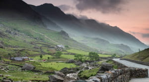
2. Llanberis to Capel Curig via A4086, Llanberis Pass, Wales
Hills and Dales, and Twists and Turns. 11 miles. Follow this route on Google Maps
Snowdonia’s Llanberis Pass isn’t just one of the UK’s greatest driving roads, it’s pretty much a rite of passage for anyone who loves cars, bikes, riding, driving, cycling, hiking, climbing, and standing in front of jaw-dropping views while the wind carries your hat into low earth orbit. Just getting to it involves journeying over several other heroic roads, some of which we’ve already covered, although none quite prepare you for the glorious feeling of gliding into the clouds as your ears pop and the landscape rushes by. It’s like looking out of a plane window just after take-off.
The pass is an A-road with a 60mph speed limit, so it’s two lanes wide for the duration, although bordered by waist-high walls from top to bottom – all the better for amplifying the sounds of engines and exhausts, which take on a lingering howl as they reflect off the rocks.
At one end is Llanberis itself, a village at the foot of Snowdon where you can catch the 4.7-mile Mountain Railway to the summit of Wales’s highest peak. At the other end the pass joins the A4086 near the Pen-y-Gwryd hotel, where Sir Edmund Hillary stayed while training to climb Everest. At the top of the road you’ll find a youth hostel and countless hikers, fastening their boots for the trek up the mountain on one of three major tracks that lead up from the car park.
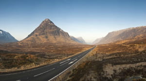
1. Crianlarich to Glencoe via A82, Scotland
Hills and Dales. 35 miles. Follow this route on Google Maps
For our final road trip, and we really have saved the best until last, we’re going to pick up the A82 again, where it spears off from Crianlarich towards Fort William. From here, the mountains rise – bottle green in the summer, frosted white in winter – and the road stretches further into the distance, as if luring you up the never-ending glens.
Through Bridge of Orchy, the black-top is as long and straight as an airport runway – until around Loch Tulla, it rears up around a sweeping hairpin bend with views back down through the valley, which often fills with swirling mist like a giant cauldron (they put a viewpoint there for a reason).
Suddenly, you’re high on a plateau and blasting through Middle Earth. Grassy verges blend into small black lochs dotted with rocky islets – you half-expect to see Gollum squatting under some lonesome tree – until, after one seemingly ceaseless curve, the road is sucked into Glen Coe, guarded by two dark hills on either side. In the 2012 film Skyfall, this is where Bond and M escaped in a silver Aston Martin DB5, while the famous scene of them standing beside the car, looking at the view, was actually filmed in the equally beautiful Glen Etive, which at this point is off to your left.
At the head of the glen the road begins its curling descent, passing rocky roadside waterfalls and the imposing triple peaks of the Three Sisters. In the layby opposite there’s often a piper in full Highland dress, busking to coachload after coachload of tourists and passers-by.
Eventually, the road tumbles down to the village of Glencoe, a great base for exploring the great outdoors and for a hike up the conical Pap of Glencoe. That is, if you don’t stay in the car for just one more drive…
What do you consider to be the best UK drives?
Did we miss anything off our list of the best UK drives? Join the conversation by email at hello@boundlessmag.co.uk or tell us on our Boundless Facebook page.
Get more with your Boundless discount
Boundless members enjoy exclusive discounts on these motoring products:
Car insurance
- Insure up to six cars on the same policy and get a discount for each one
- Choose to upgrade to a similar-sized hire car

Breakdown cover
- Three levels of cover from Britannia Rescue
- Defaqto 5 Star Rating for Comprehensive and Deluxe cover
Terms and conditions
Boundless by CSMA acts as an introducer to Liverpool Victoria Insurance Company Limited for general insurance.
Britannia Rescue is a trading name of Liverpool Victoria Insurance Company which is a part of the Allianz Group.